Drone Photogrammetry Data Processing Services
Raw drone imagery on its own is just pixels. We turn it into orthomosaics, point clouds, elevation models and CAD-ready drawings your design team can actually build on.
From Aerial Imagery to Engineering Data
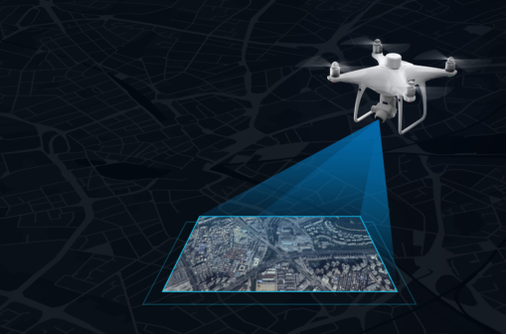
Every drone survey produces two broad families of output. Vector data — points, lines and polygons — captures discrete objects like building outlines and boundary edges. Raster data, built from pixels, captures continuous surfaces such as elevation or imagery. Getting from raw drone photos to either one takes a structured processing workflow, not a single button press.
That workflow starts with geo-referencing every image against Ground Control Points, then matching and aligning overlapping frames before generating the orthophoto, point cloud, digital surface model and TIN surface the rest of the deliverables are built from. From there we produce drawings — contours, topographic features, breaklines and text annotation — ready for direct use in design software.
Have raw drone imagery that needs processing?
Talk to Our TeamData Processing Services
Orthomosaic Image Processing
Seamless, colour-balanced, geo-referenced aerial imagery for land planning, agriculture and site monitoring.
Point Cloud Generation & Classification
High-density LiDAR and photogrammetric point clouds, classified into ground, vegetation and structures, in LAS/LAZ formats.
DEM & DSM Production
Bare-earth elevation models and full surface models supporting flood modelling, terrain analysis and volumetrics.
Contour Mapping
Precision contour lines at custom intervals for civil engineering, land development and hydrological studies.
Topographic Drawings & Annotation
CAD-ready topographic maps with GCP-referenced annotation, compatible with AutoCAD, Civil 3D and ArcGIS.
Centimetre-Level Accuracy
Every deliverable checked against ground control before it leaves our processing pipeline.
Who Relies on This Data
- Land Surveying & Civil Engineering
- Construction & Site Planning
- Agriculture & Forestry Management
- Mining & Quarrying
- Infrastructure Development
What Sets the Output Apart
Centimetre-Level Precision
Fast Turnaround
CAD/GIS/BIM-Compatible Output
Experienced GIS & Photogrammetry Team
Turn Drone Imagery Into Engineering-Ready Data
Whether you need an orthomosaic, a classified point cloud, or a fully annotated topographic survey, our team is ready to process it. Contact us to discuss your project.