Underground Utility Survey using GPR
Locate buried pipes, cables and utilities without lifting a shovel. Ground Penetrating Radar maps what is underground non-invasively, cutting the risk and cost that comes with digging blind.
See Underground Before You Dig
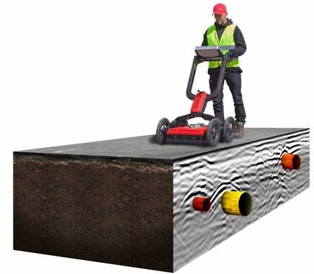
Excavation near buried pipes, cables and conduits carries real risk — one strike on a live utility can halt a project, damage infrastructure, or worse. GPR survey removes the guesswork by transmitting radio waves into the ground and reading what bounces back, building a picture of what lies beneath without disturbing a single inch of it.
The technology works across water mains, gas lines, communication cables and sewer pipes, and it is particularly valuable for non-metallic utilities — plastic pipe and concrete structures — that other detection methods often miss. A survey that would take days of careful excavation can be walked in a fraction of the time, with results ready for the design and construction teams almost immediately.
Because nothing about the ground is disturbed during the scan, GPR also flags hidden hazards before they become a safety incident on site, and it does so at a fraction of the cost of exploratory digging.
Excavating soon? Know what's underground first.
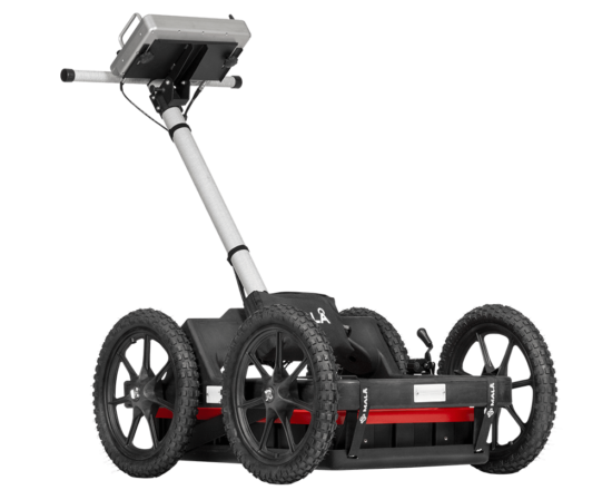
Get a Free QuoteMALÅ Easy Locator Pro WideRange HDR GPR
A wide-bandwidth ground penetrating radar system purpose-built for utility locating, paired with MALÅ Vision post-processing software to turn radar returns into a clear, interpretable picture of what's buried beneath the survey area.
80–950 MHz
Effective bandwidth
> 500 scans/sec
Data acquisition rate
Up to 8 hrs
Operating time
IP 65
Environmental rating
Benefits Over Traditional Utility Location
Non-Invasive
No excavation, no drilling — nothing about the ground is disturbed during the scan.
Fast & Efficient
Covers far more ground per day than manual excavation or exploratory digging.
Wide Material Range
Detects metallic and non-metallic utilities alike, including plastic pipe and concrete structures.
Cost-Effective
Less equipment and manpower than excavation-based location methods.
Where GPR Has Limits
No technology is perfect for every ground condition, and GPR is no exception. Signal penetration typically tops out around 20 feet before radio waves lose too much energy to reflect usefully back to the antenna. Dense clay and moist soils attenuate the signal more than dry, sandy ground, and large buried rock or debris can scatter returns in ways that complicate interpretation. Our technicians factor these conditions into the survey plan and, where the ground genuinely limits GPR, will say so rather than force a result the data can't support.
Need an Underground Utility Survey?
A professional GPR survey protects your project from costly utility strikes before excavation starts. Tell us about the site and we will scope the right survey plan.