Bathymetry Survey using Echo Sounder
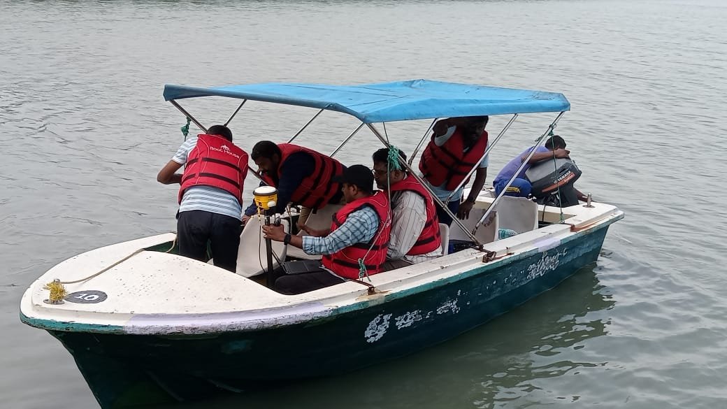
Bathymetry maps what lies beneath a river, lake or coastline — depth, seabed shape and hidden features — the same way a topographic survey maps dry land. We deliver that picture using a survey-grade single-beam echo sounder integrated with DGPS positioning.
Mapping What's Underwater
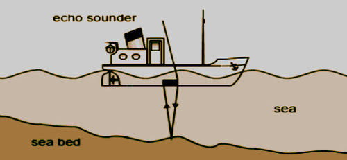
Bathymetry measures underwater depth across oceans, lakes and rivers, turning acoustic returns into a map of the underwater landscape — the wet-side equivalent of a land topographic survey. Hydrographic surveying sits one level up: it covers bathymetry as well as currents, tides and seafloor composition.
That data underpins decisions that would otherwise be guesswork — keeping vessels clear of hazards, planning ports and offshore structures, tracking environmental change, and understanding how an aquatic ecosystem actually behaves below the surface.
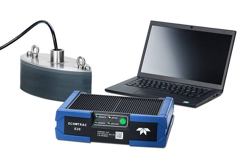
Our surveys run on a Teledyne Odom Echotrac E20 single-beam echo sounder, chosen for the balance it strikes between field-ready portability and survey-grade accuracy across everything from shallow rivers to open-water depths.
40+ years of sonar engineering behind the instrument
Dual-channel 10–250 kHz, 0.5–6,000 m depth range
Rapid mobilisation with minimal setup on site
IP67 rated — built for rugged field conditions
Planning marine construction or dredging works?
Get a Free QuoteBathymetric Survey Methodology
Survey Control & Setup
The echo sounder is rigidly mounted and aligned to the vessel, DGPS delivers sub-metre positioning, and antenna offsets, transducer draft and lever-arm values are all precisely measured before work begins.
Line Planning
Survey lines are generated to give systematic coverage of the waterbody, spaced to match project scale and bed morphology, with cross-check lines run perpendicular to validate consistency.
Field Acquisition
The vessel runs each line at a controlled speed while the echo sounder logs continuous depth against DGPS position, with draft, sound-velocity and tidal corrections applied as needed.
UAV Topographic Fill-In
Islands, banks and structures a boat cannot reach are covered by drone photogrammetry, tied to DGPS ground control points to keep the above-water and underwater data on one datum.
Processing & QC
Spikes and erroneous soundings are cleaned out, cross-lines validate accuracy, positional and vertical corrections are applied, and the bathymetric and UAV datasets are merged into one seamless terrain model.
Deliverables
Contour maps, longitudinal and cross-sections, a digital terrain model, CAD-ready DWG/DXF drawings, processed XYZ data and a full survey report — in soft and hard copy as required.
Applications
Navigation & Dredging
Safe-passage depth data and dredging volume optimisation.
Coastal & Offshore
Underwater topography for infrastructure, cable routes and wind farm planning.
Environmental Monitoring
Sediment movement, habitat condition and erosion assessment.
Underwater Exploration
Confident feature and structure detection in challenging waters.
Ready to Chart What's Below the Surface?
Tell us about your waterbody and project goals, and we will scope a bathymetric survey plan built around them.